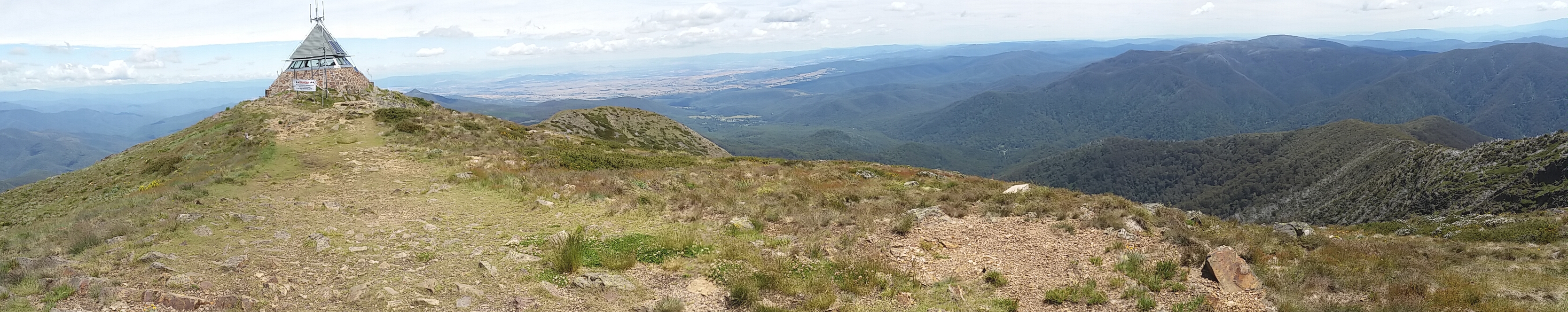
A recent ‘steps challenge’ at work had led to a discussion with one of my team about how far could reasonably be walked in a day. No firm conclusion was reached, although my personal record stood at 24km, as part of the St Phillack – Talbot Peak hike almost 3 years ago.
Wanting to test my theory out, I decided I’d take a look at walking along the Bellarine Rail Trail, which winds its way from near South Geelong train station through the Bellarine Peninsula, all the way to Queenscliff and is listed variously as 30, 32 or 35km. After sating my map fetish with a long Google Maps session, I settled on a walk from my house to South Geelong station, then along the Rail Trail, finishing up at the Queenscliff to Sorrento Ferry Terminal, roughly the furthest point south east along the Bellarine Peninsula. Google called this 40.5 kilometres, which I thought represented a nice threshold challenge – could I walk 40km in a day?
A reasonable amount of planning went into deciding how the day would pan out. For starters, I broke the trip up into smaller sections. From my house to South Geelong is about 4km, so would take me approximately 45 minutes at my fast walking pace of around 7km/h. Then I had about 19km to Drysdale station, near the high point of the rail trail, which would make a good lunch stop, before an 18km downhill section into Queenscliff. After that, I’d take a bus back to Geelong, and a short walk home from the bus stop.

The trail map
The date was fixed to be Sunday, 26th March, as I was travelling the weekend after, and the Saturday was occupied by a tennis grand final (that we lost by 4 games). The problem with the Sunday was that buses are infrequent and only run at 2:45pm and 4:45pm, taking almost 90 minutes to get home. This meant the 2:45pm bus was the one I wanted to be on, and this meant a 7am departure from home to ensure I made it with some contingency (allowing 30 minutes for lunch). I also figured I wasn’t going to keep up a 7km/h pace the whole way – particularly after a tennis grand final – so worked on the assumption of 6km/h as a constant pace.
I tried not to publicise things too much, as I wasn’t sure how I’d go, but my wife told her mother about it, and suddenly things became a bit more serious. She wasn’t sure it was a good idea to go from Geelong to Queenscliff, and raised a few good points. The more relevant one was simply that the last section between Drysdale and Queenscliff has very few exit points should I need to pull out, so that made Drysdale my decision point, and being only 23km into it, I’d likely say, “Yep, I’m fine”, keep going, and need to be airlifted off the trail 3km from my destination. The one that got me though was she wanted to go to the Queenscliff markets, and this way I could enjoy a bit more of a sleep-in, start at 9am in Queenscliff, arrive home around 4-4:30pm, and of course have my choice of taxis if I needed to pull out.

Queenscliff Ferry terminal
So, it came to pass that I found myself jumping out of the car with the family still in it, at the Queenscliff ferry terminal car park, and preparing to walk. I set up APRSDroid on my phone to beacon my position every 2 minutes via APRS-IS so they could track my location, fired up some podcasts, and started walking, 15 minutes late, at about 9:15am. The initial section is just along suburban streets to the Bellarine Rail Trail start at the Queenscliff station. As I left the station, a steam train was being fired up to travel along the parallel rail line between Queenscliff and Drysdale.

The start of the rail trail proper

Stoking the train in Queenscliff. Pozieres is famous to anyone who knows Australia’s WW1 history
From the station, you curve around Swan Bay before a bit of road walking at Murray St, and then the trail proper. The first section was completed quickly, although the cloud cover made it humid and it didn’t take long for me to be covered in sweat. I carried about 4 litres of water in my backpack, as well as lunch, which meant I was exerting myself a little more than I’d usually do on a walk. Still, I was able to maintain a pace of almost 7km/h all the way to Drysdale, with only one break for about 8 minutes while I spoke with a walker coming in the opposite direction (walking from Drysdale) who was curious about my equipment.

Swan Bay
He’d broken his hip last year, and in a giant middle finger to the universe (his words), he was planning to walk the Great Ocean Walk, from Apollo Bay to the 12 Apostles, at about 100km in length, and maybe the South West Walk after that (closer to 250km). I blew his mind when I told him about the Alpine Walking Track, 660km from Walhalla to Canberra, which he hadn’t heard of before. Once you leave Queenscliff proper, the walkers on the track disappear for the most part, and only cyclists are your real companions, so it was good to chat with a fellow lunatic heading in the opposite direction.

Suma Park railway station. Each station on the line is marked appropriately, whether still there or not. Suma Park is now a winery and the station is still used for visits when a Jazz Train runs.
The track itself between Queenscliff and Drysdale is loose blue metal gravel, but well-graded. There were a few sections where recent heavy rains had washed the finer gravel down into dips, making those sections seem like walking along a beach or in a sand pit, but there were usually enough solid areas that it wasn’t a big issue. The rail line is crossed a number of times before the final crossing near the Drysdale station, at the end of a steady increase in height towards the high point of the track. I say high point – it’s about 100m in height above sea level – but the track isn’t a steady grade up or down, and the steepest section is that bit about 2 kilometres from the Drysdale station.

The track, post Queenscliff
As I arrived, I could hear the toot of the steam train’s whistle, so I made my way to the platform of the station, and arrived about a minute before the train did. By my reckoning, that means I beat the train over 18km 😀 (averaging a pace of 8:52 min/km or 6.77km/h). I stopped here for lunch as it was now midday, and there was a nice park area to sit at, and this coincided with my parents calling me for my birthday. That made my lunch break 45 minutes instead of 30 minutes, putting me half an hour behind my original schedule, now arriving home around 4:30-5pm.
I set off from Drysdale for the longer section of the walk. The next bit takes you behind the Curlewis Golf Club, before crossing Portarlington Road after about 4km. Just as I was wondering if I’d see the family driving along the road, they pulled into a car park area on the other side, and we had a quick chat and update on my progress. I was still sweating like crazy, but the cloud cover was keeping it cooler than it could be, and I was still enjoying the walk.
The trail extends out to Leopold next, paralleling the Portarlington Road, and starting to climb a little to gain back what altitude had been lost on leaving Drysdale. The track was sealed for this section too, making progress a lot easier, and I entered the back blocks of Leopold without drama. The trail now followed the old tracks, which discontinued after Portarlington Road. An advantage of following a rail trail is that the railway folks try to avoid massive grade changes, meaning the track is elevated above sections that otherwise would be descents followed by a hard slog back uphill. Leopold represents the last high section, and it literally was all downhill from there, along a relatively smooth grade.
At Melaleuka Road, there’s the option of a 2km or so diversion to McDonald’s, but I was proud of myself for avoiding that, as I was starting to tire a little. Once past Melaleuka Road, the trail enters farming and industrial land, and this section is the dullest of the trail, as you traverse something akin to a wasteland (although without a pile of waste to worry about). I pushed on, knowing the track would cross Moolap Station Road, where I wanted to take my next break. Each minor road crossing become a bit of a false hope – was this one Moolap Station Road? Nope, onto the next one.
There are large electricity pylons that headed up to the old Alcoa aluminium smelter that used to operate at Pt Henry, and these were my reference point, but it took forever mentally to reach the road. When I made it, I had one of those revelations that make you realise how little you know your own home town, and how stupid you actually are. Moolap Station Road was, in my mind, the location of some farming homestead called Moolap Station, since carved up into an industrial suburb, because I’ve never registered there was a railway out this way. Of course, Moolap Station Road was the road to the old Moolap Railway Station. At this point, 30km in, a convenient picnic table and shelter took my pack while I rehydrated and questioned my life choices.

Moolap Station history board
I left Moolap Station, crossed the Bellarine Highway, and then things became really tough. The cloud cover disappeared, so the sun was out in full strength, and this section of the trail has little tree cover – nicely treed, but none of the shadows covered the track, so by the time I walked the 5km to South Geelong station, I was hot, sunburnt, and not real happy with my predicament. I’d kind of figured if a train was waiting at South Geelong, I’d jump on it and head the two stops home. But, of course, this time the train beat me, and, at one-all, I reasoned the universe was telling me I should keep going.
A change of t-shirt at South Geelong also made me feel a lot fresher, so I kept walking, first up Yarra St, then along Malop St, Brougham St and Mercer St. This path was chosen more to avoid having to wait at sets of lights, although I couldn’t escape it entirely, and my pace slowed a little as a consequence. 39 km in, I reached the footbridge over the main Geelong/Melbourne train line, and realised I’d have one last serious uphill to tackle, albeit a short one.

The footbridge uphill.
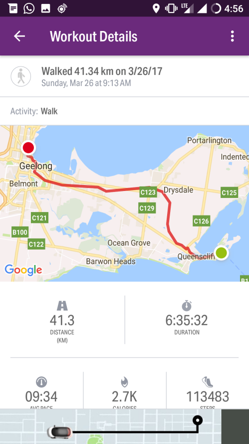
From there, I went to the bottle shop near home, arriving right at the 40km mark, in order to purchase a beer to celebrate. I grabbed a six-pack because they were on special, and, with another few kilograms weighing me down, covered the last 1.3km in good order. I arrived home at 4:45pm, which, given my initial estimate, I was pretty pleased with, having averaged 9:34 min/km (6.27 km/h) over 41.34km in total. The pedometer registered 47,766 steps for the day. In the last 3 km I passed at least 6 cafes, 1 McDonald’s, 2 bars, 3 types of Asian food, 2 wood fired pizza bars (located next to each other) and a gelateria. Yet the only place I stopped was a bottle shop for beer!

An ironically named beer. Carrying six of these 1.3km was totally worth it.
I cracked open a beer, ran a bath, and did absolutely nothing for the rest of the evening!
The path

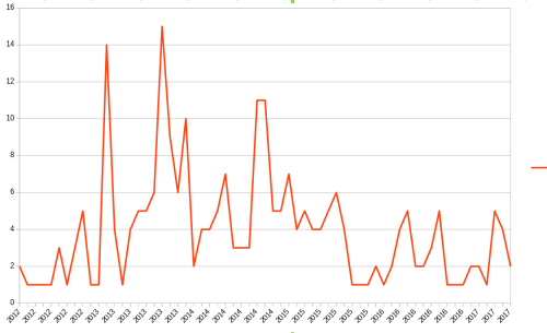
Total distance